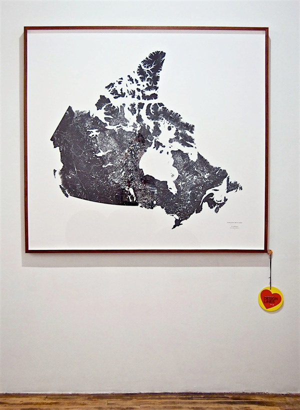
Hydrological Map of Canada.
Scale 1:5 000 000 or 1 centimetre represents 50 kilometres
Dimensions 140cm x 130cm
Archival Giclée Print
Edition of 10
When our natural environment is recorded as data there is a quantitative image produced which is quite inspiring.
For this Hydrological Map, I began with raw data files available from the Government of Canada and generated this representation of our country where land is rendered black and every canal, creek, brook, river, basin, lake, and body of water appears in white.
Water is vital for all known forms of life. This map provides one with the capacity to understand the vast interconnected nature of Canada’s water.